Our July Map of the Month is this 1848 “Mexico & Guatemala” map published just before the end of the Mexican-American War by S. Augustus Mitchell. It features a detailed depiction of the various international and state boundaries of Mexico and Central America at the time, many of which were altered soon after this map’s publication. It also includes several markers indicating significant cities and battles in the Mexican-American War.

The Mexican-American War began in 1846 as a dispute over the territory of Texas and where the border between the United States and Mexico fell. In 1845, the United States moved to annex the Republic of Texas, which had long claimed its territory extended to the Rio Grande as shown on this map. However, Mexico refuted this claim and countered that Texas’ territory ended at the Nueces River, about 150 miles north of the Rio Grande. The territory between these two rivers, referred to as the Nueces Strip, became a high point of contention between Mexico and the United States as the U.S. abided Texas’ claim and annexed the land all the way up to the Rio Grande.

U.S. and Mexican forces first clashed on the Nueces Strip in early 1846 before a formal declaration of war had even been made between the two nations. There were multiple battles in this area before war was declared, including two highly significant battles just above the Rio Grande denoted with small black flags on this map. The Battle of Palo Alto and the Battle of Resaca de la Palma occurred on May 8, 1846 and May 9, 1846, respectively. The Battle of Palo Alto began as U.S. troops were intercepted by Mexican forces on their way to assist Fort Texas. The battle soon turned in the U.S.’s favor as its troops used their superior artillery to overpower the Mexican troops, leading them to retreat. After regrouping, they engaged the U.S. troops again the next day but were once again overpowered and forced to retreat. This second retreat allowed the U.S. force, led by General and future president Zachary Taylor, to cross the Rio Grande and directly attack Mexican territory.

The United States formally declared war on Mexico on May 13, 1846. The Mexican-American War ended on February 2, 1848 with the signing of the Treaty of Guadalupe Hidalgo. In the end, thousands of soldiers and civilians were killed in the conflict and the land exchange outlined in the Treaty dramatically reshaped both nations’ territories and futures. At the beginning of the Mexican-American War, Mexico’s territory stretched from the Yucatan Peninsula all the way to the U.S.-owned Oregon Territory as depicted on this map. However, in the Treaty of Guadalupe Hidalgo, Mexico agreed to cede approximately half of its land to the United States. This land would eventually make up the states of California, Arizona, New Mexico, Nevada, Utah, Colorado and parts of Wyoming, Oklahoma, and Kansas. The effects of this cession greatly influenced the events of the next few decades in both nations. The Mexican-American War was one of several events that contributed to the growing tensions in the United States leading up to the Civil War. Divides widened along party lines throughout the war as the Democrats and Whigs held fiercely oppositional opinions about going to war with Mexico, and the new land gained at the end of the war contributed to increased debate on the issue of slave versus free states. In Mexico, the loss of the war and mass cession of land to the United States was viewed as a national disgrace and contributed to the rising tensions that culminated in a civil war between the nation’s conservative and liberal factions.
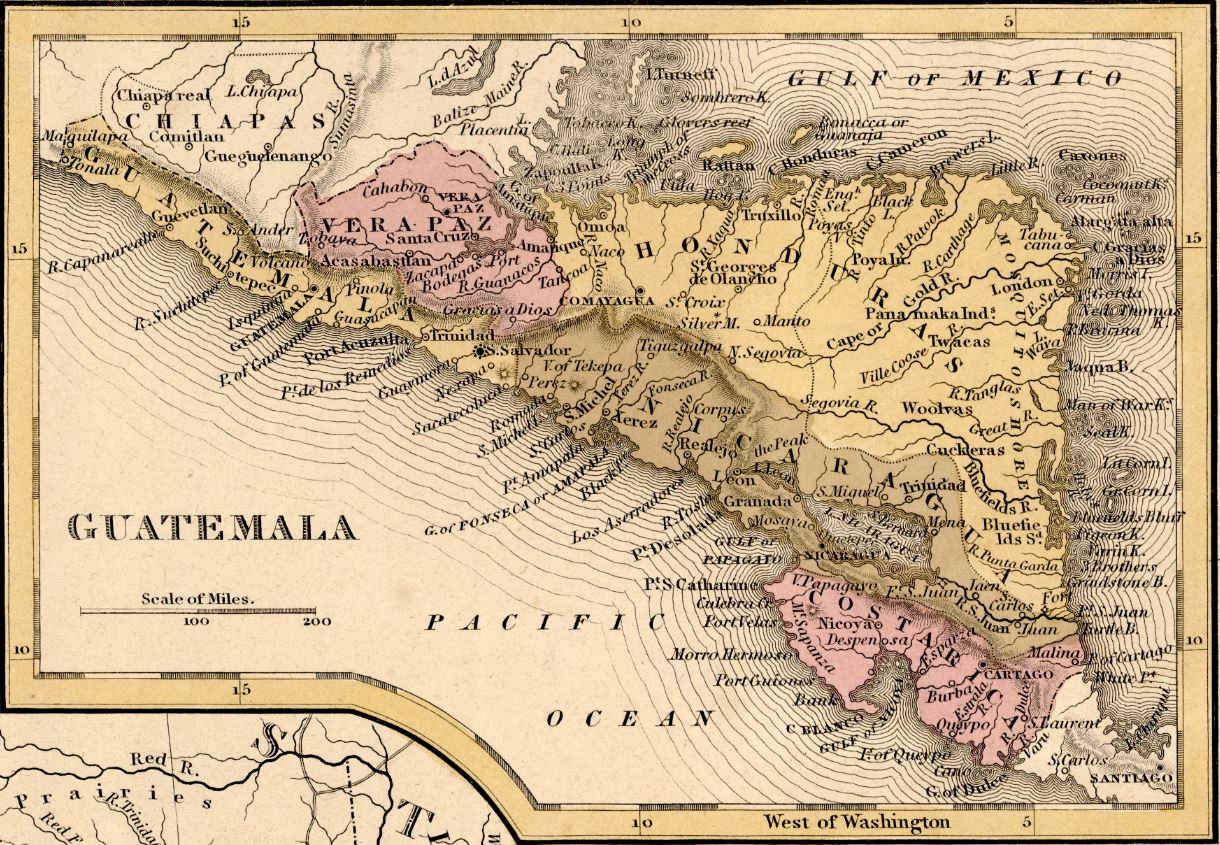
In addition to its detailed depiction of Mexico, this map also features a “Guatemala” inset of the Central American nations. The inset depicts borders and territories that look quite different from the Central American states of the present. On this map, the territory of Guatemala is significantly smaller than its modern counterpart, which extends into the Yucatan Peninsula. Similarly, Honduras and Nicaragua are different sizes and shapes in the present than they are depicted here, while other nations like El Salvador are not even independently depicted on this map. These borders and territories continued to shift over the next several decades, often as a result of attempts to unify the Central American states followed by periods of staunch support for individual state sovereignty. The borders of present-day Central America began to take clearer shape by the early 1900s and became largely solidified despite various conflicts throughout the region.

We hope you enjoyed this month's map! As with all of our Map of the Month features, if you’d like to learn more about this map or schedule a visit to explore our maps in person, please submit a Map and Geo Service Request. We’ll be sure to get back to you within two business days, but typically sooner.
- Kelsey Kerley, Map and GIS Assistant