The political boundaries of North America have gone through many changes. As part of New Spain, Central America was known as the Captaincy General of Guatemala, or the Kingdom of Guatemala. The territory of Mexico used to contain the entire southwestern United States, and extended as far north as the Great Salt Lake in Utah.
This month, we’ll be looking at 'Mexico & Guatemala, With The Republic of Texas', published by W. Lizars Edinburgh. It was produced in 1840, during the brief period where Texas was an independent country after having won its independence in the Texas Revolution in 1836. It shows just a snapshot of the current territorial possessions, which would change drastically before the decade was over.

After Texas was able to successfully “Remember the Alamo!” (as the famous Texas battle cry went) and gained its independence in 1836 at the conclusion of the Texas Revolution, the new nation applied for annexation to the United States. That didn’t happen for nearly a decade; thus Texas was its own sovereign nation — at least temporarily.

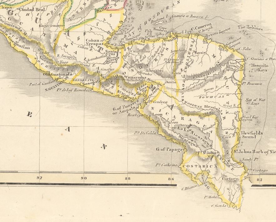
Moving to the southern border of Mexico, we encounter a significantly upsized Guatemala — written as 'Guatimala' on this map — encompassing everything in Central America from modern-day Mexico to Costa Rica. After gaining independence from Spain, the Kingdom of Guatemala took on a new form as the Federal Republic of Central America and all constituent regions became their own states, on which the modern nation-states are based. In fact, most of the Republic was embroiled in a civil war that had begun two years earlier. In 1841, the Republic was dissolved.
Moving back north to upper Mexico, we get to see the section of the map that covers the Mexican State of New California. Fast forwarding to the present day, that old Mexican state is now composed of the U.S. States of Arizona, New Mexico, Nevada, Utah, and California. Unfortunately, the American West at this point is largely unexplored. It’s as if the American West is a barren landscape with no discernable features.

Those are just a few highlights of what can be found on this map. There’s plenty more to see!As with all of our Map of the Month features, if you’d like to learn more about this map or schedule a visit to explore our maps in person, please submit a Map/Geo Service Request and we’ll be sure to get back to you within two business days, but typically sooner. As always, we hope you enjoyed this map showcase and hope you look forward to next month!
-Eric Friesenhahn, Map and GIS Specialist