On Thursday, December 8, the Map and Geospatial Hub team was awarded the 2022 ASU President’s Award for Innovation for its custom-designed, custom-built Map and Geospatial Hub 3D Explorer application.
The Map and Geospatial Hub 3D Explorer is a new online tool for scaling the accessibility of library resources for ASU’s global community of lifelong learners and educators. It is a customized web application integrated with a dynamic, interactive 3D map scene developed with state-of-the-art geographic information systems (GIS) technologies.
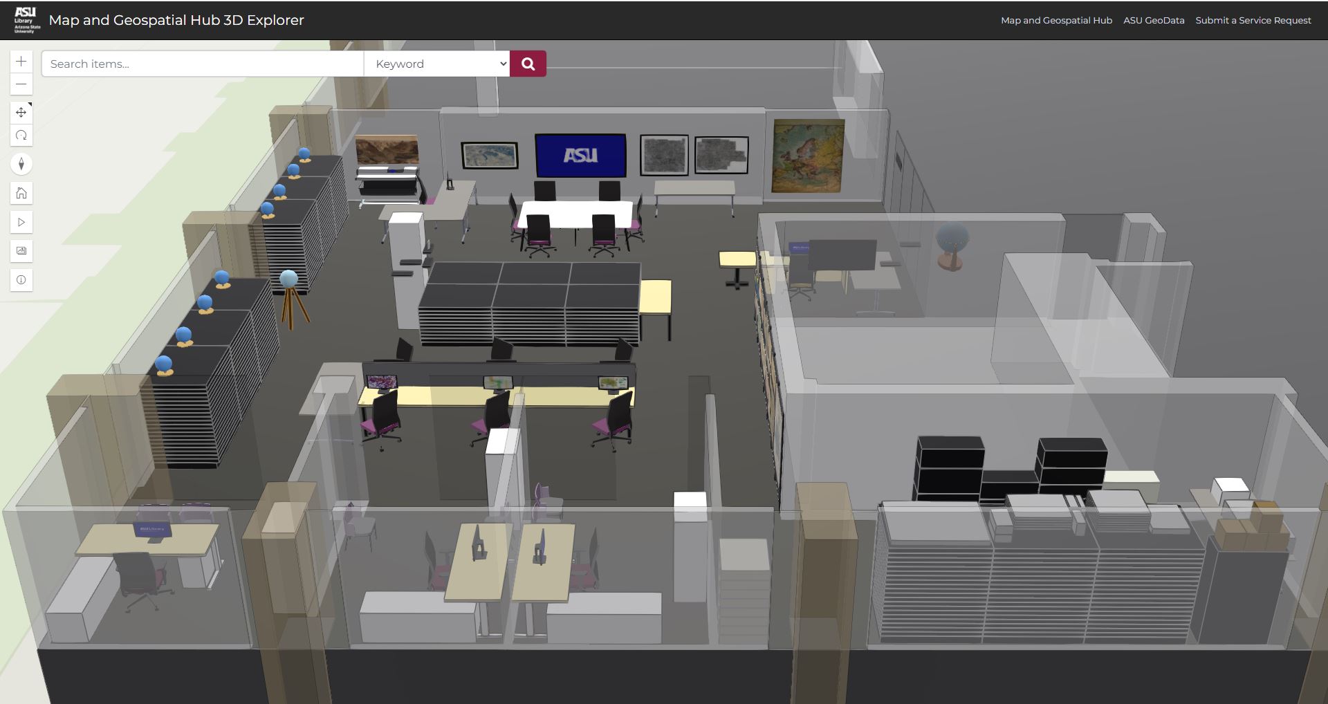
The 3D scene models the interior space of the Map and Geospatial Hub, the ASU Library unit centered on cartographic and geospatial information resources. The Map and Geospatial Hub is a traditional library-based map collection fused with a modern GIS center.
In our physical reality, the Map and Geospatial Hub is located in Hayden Library on ASU’s Tempe campus. The 3D Explorer application virtualizes the Hub space — and the rich geographic information resources contained therein — making all of it accessible from anywhere in the world.
The 3D Explorer empowers users to virtually tour and explore an engaging library space while discovering and digitally accessing its geographic information resources. These resources directly support transdisciplinary learning, research, and knowledge creation at ASU and beyond. Users can conduct text- and location-based searches for diverse collections of maps, aerial photographs, and other geographic information.

In the application, users can access over 68,000+ map records and interact with over 75 digital 3D models to accurately represent the physical space in a virtual web-based environment.
Search results are delivered with exceptional levels of locational accuracy. Maps and other items are located and visualized down to their individual drawer or shelf location.
The application also boasts additional custom features designed to enrich the virtual experience, including an embedded 360-degree panorama photo viewer.

ArcGIS Online, which hosts the 3D Explorer, is a cloud-based GIS software-as-a-service manufactured by Esri, the GIS industry’s global leader. ArcGIS Online offers a myriad of location intelligence, data analysis, and web application development tools.
The core component of the 3D Explorer web application — the 3D model — resides within the ArcGIS Online ecosystem as what’s called a “web scene”. By publishing the web scene live on the Internet, ArcGIS Online offers a simple dashboard reporting basic usage statistics. From ArcGIS Online, the 3D Explorer was viewed on the web 10,234 times in 78 different countries as of when this article was written.

Hub staff members Eric Friesenhahn (Map and GIS Specialist), Jill Sherwood (former Geospatial Data Analyst), and Matthew Toro (Director of Maps, Imagery, and Geospatial Services) received the award on behalf of the team. Unfortunately absent from the event was Robert ‘Bob” Cowling (former Map and GIS Intern), who worked remotely, based out of Michigan, while indispensably serving as the application’s software architect.

Earlier this year, the team was also awarded a 2022 Esri Special Achievement in GIS (SAG) award for the 3D Explorer.
The ASU President’s Award for Innovation “recognizes ASU personnel who demonstrate the university’s commitment to higher education through the development and execution of innovative projects, programs, initiatives, services and techniques.”
Read more about the 2022 President’s Award ceremony in the recent ASU News piece: 2022 President’s Awards honor ASU employees (December 13, 2022).