Map and Geospatial Hub news

Hub Director Featured in American Libraries Magazine
Matthew Toro, ASU Library’s director of maps, imagery, and geospatial services, was featured in the September/October 2021 issue of American Libraries magazine. The brief magazine feature, titled “On the Map”, offered insights from three geospatial library professionals on ...

ASU News: Mapping the ASU Library map collection
View the full ASU News article, Mapping the ASU LIbrary mapp collection, written by Britt Lewis, and published on August 20, 2021, at the following URL: https://news.asu.edu/20210820-mapping-asu-library-map-collection ...

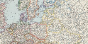
Map of the Month: August 2021
Our August Map of the Month is this National Geographic map titled Europe and the Near East. It displays a comprehensive post-WWII view of Western and Eastern Europe as well as the North African Coast and part of the Middle East. Published in 1949 after the conclusion of several years of negotiat...

Esri License Renewals
You may have seen a warning that your Esri software license is set to expire. The warning appears because ASU's license agreement with Esri renews at the end of the month. This happens every year; it is expected and normal. Here’s what you need to do, depending on the E...

New Map Collection and Index: Metro Phoenix Land Use Maps
The index for our new digital image collection, Metro Phoenix Land Use Maps, is now available to the public here. Metro Phoenix Land Use Maps Web App with Pop-up The Metro Phoenix Land Use Maps collection is an interactive web ma...

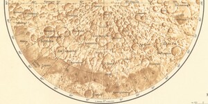
Map of the Month: July 2021
Our July Map of the Month is this 1967 Soviet lunar map from the series titled Polnaya Karta Luny Complete Map of the Moon. The series is made up of nine sheets that display several magnified lunar quadrant maps, translations of the labels throughout the series, and this final composite lunar pole m...

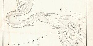
Map of the Month: June 2021
Our June Map of the Month is this 1844 Plan de l'embouchure du Rio Colorado dans la Mer Vermeille (English title: Plan from the Mouth of Rio Colorado in the Ruddy Sea). It is a French survey of the mouth of the Colorado River that displays information on the river’s depth, islands, and other navigat...

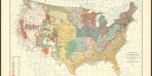
Map of the Month: May 2021
Our May Map of the Month is this Reconnoissance Map of the United States by William John McGee from 1893. It displays the geologic variation throughout the regions of the United States as documented at the time by the U.S. Geological Survey and various state Geological Surveys. ...

Map of the Month: April 2021
Our April Map of the Month is this 1909 Linguistic Map of Mexico and Central America by Cyrus Thomas and J.R. Swanton. It displays the geographic distribution of a variety of Mesoamerican languages and dialects throughout Mexico and Central America. ...