Map and Geospatial Hub news
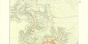
Hub Hiring Project-Based Student Worker: Dutton's Atlas (Spring/Summer 2022)
The Map and Geospatial Hub at ASU Library has a new project-based student worker position available for Spring/Summer 2022. The posting is officially listed as “Library Aide III” (job ID: 75253BR), but the working title is GIS & Multimedia Research Associate. The position will support a new p...
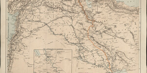
Map of the Month: January 2022
Our January Map of the Month is this 1916 map of “The Theatre of War in Mesopotamia”, displaying Mesopotamia (modern-day Iraq and Syria) and Persia (modern-day Iran) as they appeared in the midst of World War I. This map was published in Edward Stanford’s War Map No. 9 and includes an inset of “The...
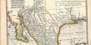
Map of the Month: December 2021
Our December Map of the Month is this French map titled “New Mexico, with the Northern Part of Old, Or New Spain”. Among the oldest maps in our collection, this map was made by Rigobert Bonne and was published in 1780 as part of Guillaume-Thomas Raynal’s famous Atlas de Toutes Les Parties Connues du...
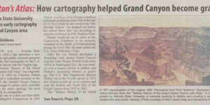
Williams-Grand Canyon News: Dutton’s Atlas: How cartography helped Grand Canyon become grand
View the full Williams-Grand Canyon News article, Dutton’s Atlas: How cartography helped Grand Canyon become grand, written by Joe Giddens, and published on October 12, 2021, at the following URL: https://www.williamsnews.com/news/2021/oct/12/duttons-atlas-how-cartogr…...
Map of the Month: November 2021
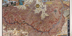
Our November Map of the Month is this illustrated map titled “Grand Canyon” by Uruguayan-American artist Jo Mora. The map depicts approximately one fourth of the Grand Canyon, focusing on the portion most frequented by tourists. It features a variety of insets and illustrations highlighting the main...
Map of the Month: October 2021
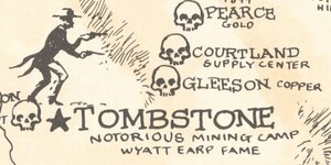
Our October Map of the Month is this 1963 map titled “Arizona’s Lost Mines and Ghost Towns”. It features some of Arizona’s most famous lost mines and ghost towns as well as the more obscure, and it includes many illustrations related to Arizona’s history and the “Wild West” era that these towns and ...

Hub Hiring Two Student Workers (Fall 2021)
The Hub is Hiring! The ASU Library Map and Geospatial Hub is searching for two new student workers to join our team! Any interested students should be sure to apply by the application deadline of October 8th. Students do not need a background in GIS, as we hire all majors. ...
ASU News: How cartography helped the Grand Canyon become grand
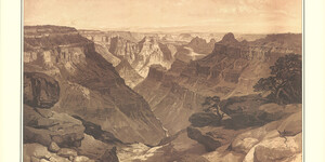
View the full ASU News Article, How cartography helped the Grand Canyon become grand, written by Lauren Whitby, and published on September 28, 2021, at the following URL: https://news.asu.edu/20210928-arizona-impact-how-cartography-helped-grand-canyon-become-grand ...

Map of the Month: September 2021
It’s been one month since Sun Devils came back to campus after nearly 16 months of remote learning. To celebrate our return to in-person learning, our September Map of the Month is this 1980 illustrated map of Tempe, Arizona. It highlights many of Tempe’s community landmarks and provides a look at j...