From the San Francisco peaks to the banks of the Salt River, Arizona is arguably one of the most breathtaking states in the continental U.S. While many people carry generalized ideas about the physical geography of Arizona, the state is actually quite diverse in terms of environment and climate.
This month's map, ‘The Heart of Arizona’, was published by G.A. Eddy in 1926. It's a pictorial map, artistically drawn in an oblique, state-wide perspective. The map illustrates major geographic icons of the state during the Roaring Twenties, a time of explosive economic growth.

The map has multiple sketches of Arizona landmarks. The Theodore Roosevelt Dam, which created Lake Roosevelt along the Salt River, is currently the largest dam/hydroelectric power plant in the state, with the dam holding back about 1.6 million cubic feet of water and having a generating capacity of 36 megawatts.

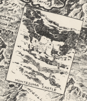
Along with the Roosevelt Dam, we have places such as Montezuma Castle. Montezuma Castle is a series of cave dwellings in Campe Verde, created by the Sinagua people, a pre-Columbian culture which is closely related to the Hohokam. The principal structure of the castle is about five stories with 20 rooms, and the entire community was built over the span of three centuries.
Along with places of interest, Arizona is known for the 5C’s: Cotton, Cattle, Copper, Citrus, and Climate. Specifically, the copper industry was at one point one of the largest industries in the state, and in the present day still plays a major role in the state's economy. Some of the mines, like the Morenci Mine in Greenlee County, one of the largest copper mines in the world, are still active, producing about 480,000 metric tons of copper a year.
The copper mining industry was the backbone of the Arizona economy up until the early eighties when strikes and layoffs forced many mines to close, causing a decline in the industry. And though many of these mines and smelters are no longer in operation, you can still see the remains of many of these mines. Despite these closures, copper is still a major pillar of the state economy.
We hope you enjoyed our May 2025 Map of the Month!
- Title: The Heart of Arizona
- Date: 1926
- Author/Publisher: G.A. Eddy
As with all of our Map of the Month features, if you’d like to learn more about this map or schedule a visit to explore our maps in person, please submit a Map/Geo Service Request. We’ll be sure to get back to you within two business days, but typically sooner.
-Robert Wickett, Map and GIS Assistant
Citations:
“Theodore Roosevelt Dam and Lake | SRP.”
<www.srpnet.com/grid-water-management/water-management/lakes/theodore-roosevelt-dam-lake>.


