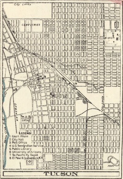
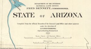
On February 14, 1912, the Territory of Arizona became a state at the end of one of the most complex journeys to statehood in American history. To celebrate Arizona’s statehood anniversary, February’s Map of the Month is titled State of Arizona and depicts Arizona in 1912, only a few months after it became a state, and includes city plans of Tucson and Phoenix.

The majority of Arizona’s land was ceded to the United States in 1848 as part of the Treaty of Guadalupe Hidalgo. The land of southern Arizona (including the counties Cochise, Graham, Pima, Pinal, Santa Cruz, and Yuma) was bought by the United States in the Gadsden Purchase of 1853 with the intention of constructing a southern transcontinental railroad.

Despite its annexation into the United States, Arizona was not made an official territory. Instead, it was half of the large New Mexico territory, comprising both present day Arizona and New Mexico. In 1856, settlers petitioned Congress to create a separate Arizona Territory and after being refused on multiple occasions, they would go on to accept the proposal for an Arizona Territory made by the Confederate States of America in 1861.
The Arizona Territory of the Confederacy was established in 1862 and comprised the bottom half of the Union’s New Mexico Territory. This caught the attention of President Lincoln, who quickly stepped in and established the Arizona Territory of the United States in 1863, dividing it from New Mexico along the border that remains today. Even after this promotion, it would take Arizona 49 more years to achieve statehood.
There were several reasons the U.S. government was uninterested in making Arizona a state, including the desolate landscape, lack of water, and above all, the rough inhabitants known for their “Wild West” mannerisms. Therefore, it wasn’t until 1903 that the United States offered statehood in the form of a joint state with New Mexico. Arizonans firmly vetoed the idea and held out until separate statehood was offered to them in 1910.

Arizona’s Constitutional Convention lasted 60 days and its product was one of the most notoriously progressive constitutions in the nation’s history. It included practices of initiative, referendum, and recall, even for judges. The idea of judges being subject to recall (removal from office by vote of the people) was particularly inflammatory to President Taft, who had previously served as a judge. He gave Arizona an ultimatum: remove judicial recall or he would veto the constitution.
The clause was eventually removed and on February 14, 1912, Taft signed the papers to make Arizona the 48th state. Ironically, Arizona went on to include a proposition for judicial recall as well as suffrage for women on the ballot of its first election, and both propositions passed with a wide majority, solidifying Arizona’s reputation as a progressive and willful state.
Some of Arizona’s most iconic features are not included on this map. The National Parks Service was not created until 1916, so none of Arizona’s three national parks are present. Grand Canyon National Park and Petrified Forest National Park were established as national monuments in the 1900s so both are identified here, but the land that would eventually be designated as Saguaro National Park is part of the Coronado National Forest on this map. The Tohono O’odham Reservation, the third largest Indian Reservation in the country, is also not present, but part of its future territory southwest of Tucson is labeled “Papago Indian Reservation”. Phoenix and Tucson, now the largest and most populous cities in Arizona, are only a fraction of their current sizes, and much of the Phoenix metropolitan area does not yet exist on this map as it underwent most of its development in the 1940s and 1970s.
As with all of our Map of the Month features, if you’d like to learn more about this map or schedule a visit to explore our maps in person, please submit a Map and Geo Service Request. We’ll be sure to get back to you within two business days, but typically sooner.
-Kelsey Kerley, Map and GIS Assistant