Library news

What does the NIH 2023 Data Management and Sharing Policy mean for you?
By Janice Hermer, Karalyn Ostler, Kevin Pardon, and Matthew Harp A new National Institute of Health (NIH) Data Management and Sharing Policy goes into effect on January 25, 2023. The last policy was implemented in 2003, nearly twenty years ago! With this update, all NIH gr...

Dutton's Atlas Symposium: Register Now
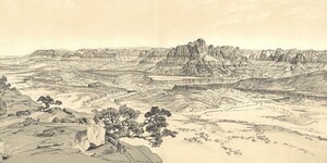
Join us for an engaging, entirely free and open-to-the-public symposium event offering insightful, thought-provoking presentations on the various historical-geographical and socio-cultural dimensions of Dutton's Atlas! There will also be a physical exhibit showcasing works from the Atlas and Monogra...

Labriola Blog: Office of Indian Education Symposium
Labriola National American Indian Data Center's Director, Alex Soto, providing a Land Acknowledgement at Office of Indian Education's Symposium. Celebrating Indigenous People’s Day, the Labriola National American Data Center ki...

Max Liboiron to deliver Labriola Center’s National Book Award lecture
You are invited to watch the Labriola National American Indian Data Center 2022 National Book Award talk featuring “Pollution Is Colonialism” by Max Liboiron (Red River Métis/Michif). The book presents a framework for understanding scientific research methods as practices that can align with or agai...

Map of the Month: October 2022
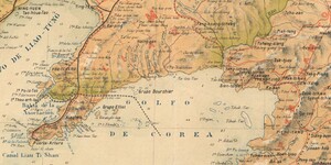
Our October Map of the Month is this undated Spanish map titled “Corea y Sur de Mandchuria” (Korea and South Manchuria). It depicts the Korean Peninsula and Southern Manchuria just prior to the start of the Russo-Japanese War, before Japanese occupation and the Division of Korea. It includes various...

Solving human problems through nature, a guide to Naturespace
Where can you go to find seeds, shells and a taxidermy Gila monster? The ASU Library’s Naturespace, now open at Hayden Library, offers access to an interactive natural history collection for students, faculty, staff and community. From engineering to design, the collection offers visitors the abilit...

'Tempe Sister Cities' exhibit celebrates citizen diplomacy at ASU Noble Library
The ASU Library, in collaboration with Tempe Sister Cities and The Melikian Center: Russian, Eurasian and East European Studies, celebrates 50 years of citizen diplomacy in the Sister Cities program. Visitors to Noble Library on the Tempe campus can explore stories and photographs documenting the p...

3 takeaways from the 2022 White House Office of Science and Technology Policy
Anali Maughan Perry - Head, Open Science and Scholarly Communication It’s been an exciting first month of the semester, especially with the White House Office of Science and Technology Policy (OSTP) releasing a memorandum on Ensuring Free, Immediate, and Equitable Access to Federally Funded Researc...

Map of the Month: September 2022
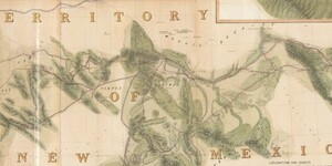
Our September Map of the Month is this mid-1800s map exploring the feasibility of constructing a trans-continental railroad route through Arizona. The full title is “Explorations and Surveys for a Rail Road Route from the Mississippi River to the Pacific Ocean, Route Near the 35th Parallel, Map No. ...