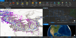
Join the ASU Library Map and Geospatial Hub for an intensive, hands-on, 3-hour workshop to celebrate ASU GIS Day 2020.
Friday, November 20
2:00pm-5:00pm
Map and Geospatial Hub [Online via Zoom]
We'll be linking data, maps, and apps with ArcGIS Pro (desktop GIS software) and ArcGIS Online (web GIS software), two major components of the ArcGIS ecosystem.
This is an introductory workshop -- perfect for beginner or intermediate GIS users who wish to become more familiar with desktop-to-web workflows and the integration possibilities of the ArcGIS ecosystem.
We'll explore the creation of 2D maps and 3D scenes visualizing geospatial data imported from our own local machines, as well as from online sources. We'll then interconnect our desktop (ArcGIS Pro) and web (ArcGIS Online) GIS software to open new possibilities for collaboration, and to share our geospatial analysis and visualization projects with the world.
Workshop participants should come to the workshop with ArcGIS Pro already installed onto their personal devices.
ASU affiliates can follow the instructions found at the following link to access these desktop and web GIS software applications:
- ArcGIS Online: https://libguides.asu.edu/esrisoftware/arcgisonline
- ArcGIS Pro: https://libguides.asu.edu/esrisoftware/arcgispro
Participation is free and open to the public, but non-ASU attendees must have come to the workshop with their own access (full independent licensing) to ArcGIS Pro / ArcGIS Online.
We look forward to seeing you there!
