Library news

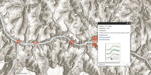
New Web Index: 1988 Hydraulic Maps of Major Grand Canyon Rapids
Our latest web index, 1988 Hydraulic Maps of Major Grand Canyon Rapids, is now live and available to the public. Geographic Coverage: Arizona Date: 1988 Scale: 1:1,000 Physical Availability: in-house only Digital Availability: scanned (600 dpi) This application depi...

Rosa Lee Scott: Actress, Artist and Educator
The Child Drama Collection is the world's most comprehensive archival repository of manuscripts, ephemera, and educational materials related to the history of theatre for youth and drama in education. The collection contains over 2600 linear feet of manuscripts and over 700 print materials of plays ...

ASU Library, School of Art collab celebrates 10 years with new student exhibition
“Time and Change” is the title for a new art exhibition on display from Nov. 11–27 at Noble Library on the Tempe campus showcasing the creative problem-solving by students using cartographic materials. The exhibition includes both two-dimensional and three-dimensional original works of art on topogr...

Author Valerie Lambert to deliver Labriola Center National Book Award lecture
The Labriola National American Indian Data Center at the ASU Library has announced that “Native Agency: Indians in the Bureau of Indian Affairs” by Valerie Lambert is the recipient of the center’s National Book Award. The annual award recognizes scholarship in American Indian and Indigenous studies....

Map of the Month: November 2023
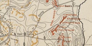
In 1898, Cuba was in the midst of a bloody war for independence from Spain that had been raging for three years. American public opinion swayed dramatically towards support through the 1890s, especially with American journalists fully embracing Yellow Journalism to exaggerate and embellish the atroc...

Labriola Blog: October 2023 Highlights
Highlights from the Labriola Center October's events at the Labriola National American Indian Data Center oscillated around themes of Indigenous identity in academia, which includes the Office of Indian Education's Symposium, Vina Begay's Archive Wednesday, a book talk with Ramona Emerson, and the ...

Makerspace student recognized at Hacks for Humanity event
The 2023 Hacks for Humanity: Hacking for the Social Good event from Oct. 6-8 brought together undergraduates, high school students, professionals and community members from across the valley to innovate technology for the social good. Hosted by ASU’s Project Humanities, the event aims to address loc...

Open Access Week 2023 next steps
For our Open Access Week 2023 series, we have covered a lot of ground on the benefits and challenges, context and opportunities around open research and scholarship. In the first post, we shared the definitions of open access and the meaning behind this year’s theme, Community Over Commercialization...

Map of the Month: October 2023
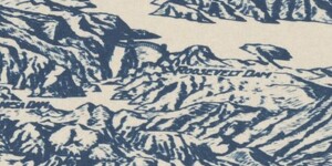
Salt River Valley, Arizona, 1934. Cartography by T.A. Hayden. In 1934, the Phoenix valley was mostly farmland thanks to the incredibly successful damming of the Salt River with the Roosevelt Dam via the Salt River Project i...