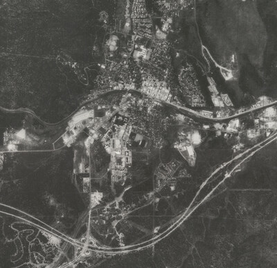
If you’re looking for aerial photographs of Arizona from the 1970’s, the USGS Orthophotos are a good place to start. The scale for these black and white photos is 1:24,000 and they line up with the USGS 7.5’ topographic map series.
These photos are housed at the ASU Map and Geospatial Hub. While they are not currently digitally available, you can use the AZ Orthophoto Index (1971-1976) Web Map index to see the coverage for your area. Once you've identified the orthophotos you're interested in, simply submit a short Service Request with the photo name, and we'll prepare the physical image for viewing here at the Map and Geospatial Hub.
- Geographic Coverage: majority of Arizona
- Time Range: 1971-1976
- Cartographic Scale: 1:24,000 (7.5’ USGS topographic map grid)
- Physical Availability: in-house use only
- Digital Availability: not yet scanned

To learn about other aerial photos in the collection visit our Aerial Photography page.
By Karina Wilhelm, Map Specialist
Image: Flagstaff, AZ showing Route 66 through town and the newly constructed I-40 bypass (1973).